
Prime Minute delivers an integrated operational solution for wildfire response in all conditions.
We start with the mission and work backward from what it takes to solve it, then bring together our platform, technology, and engineering capabilities to build a solution that performs where it matters most.

The Mission
Filling the void of denied-environment operations
Wind, smoke, night, and terrain lock conventional aerial firefighting out — and fires burn unopposed. Prime Minute fills that void: containing fires while they are small, and buying the minutes that decide the outcome.
The Denied Environment
Where conventional aerial firefighting can't go, Prime Minute can.
1/5
High wind
Tankers grounded; drops drift off target. We penetrate winds up to 150 mph.
2/5
Smoke & visibility
Degraded visual environment denies manned aviation. Guided units don't need to see.
3/5
Night
Two-thirds of the ops clock is denied to conventional aerial firefighting. We operate day and night.
4/5
Remote & harsh terrain
Hours from the nearest crew, road, or water source. Ten minutes from us.
5/5
Extreme fire intensity
Convective columns and turbulence keep aircraft at standoff. Our platform stays above it all.

IN ACTION
Software
We meet the moment by turning raw data and real-time conditions into immediate action.
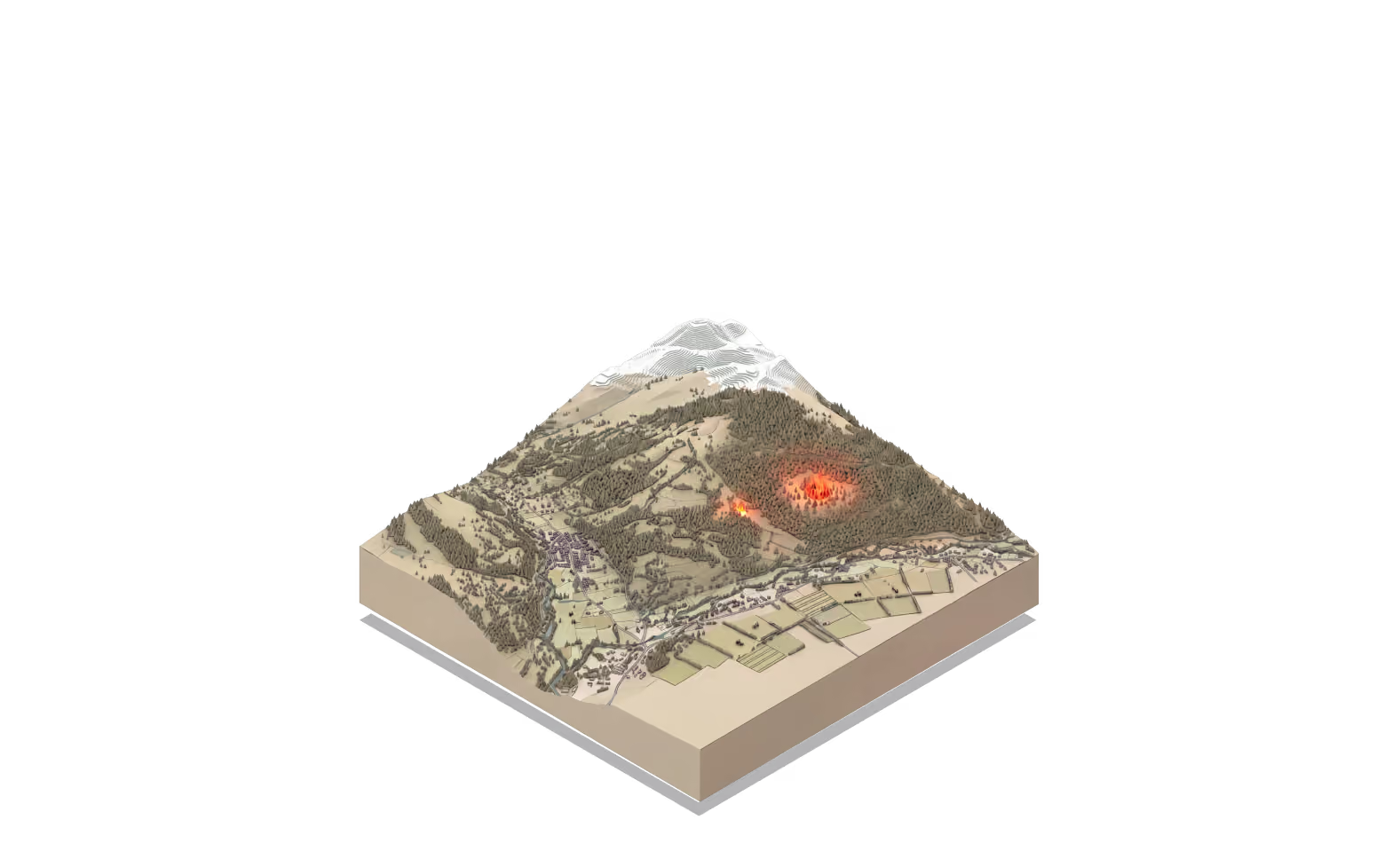
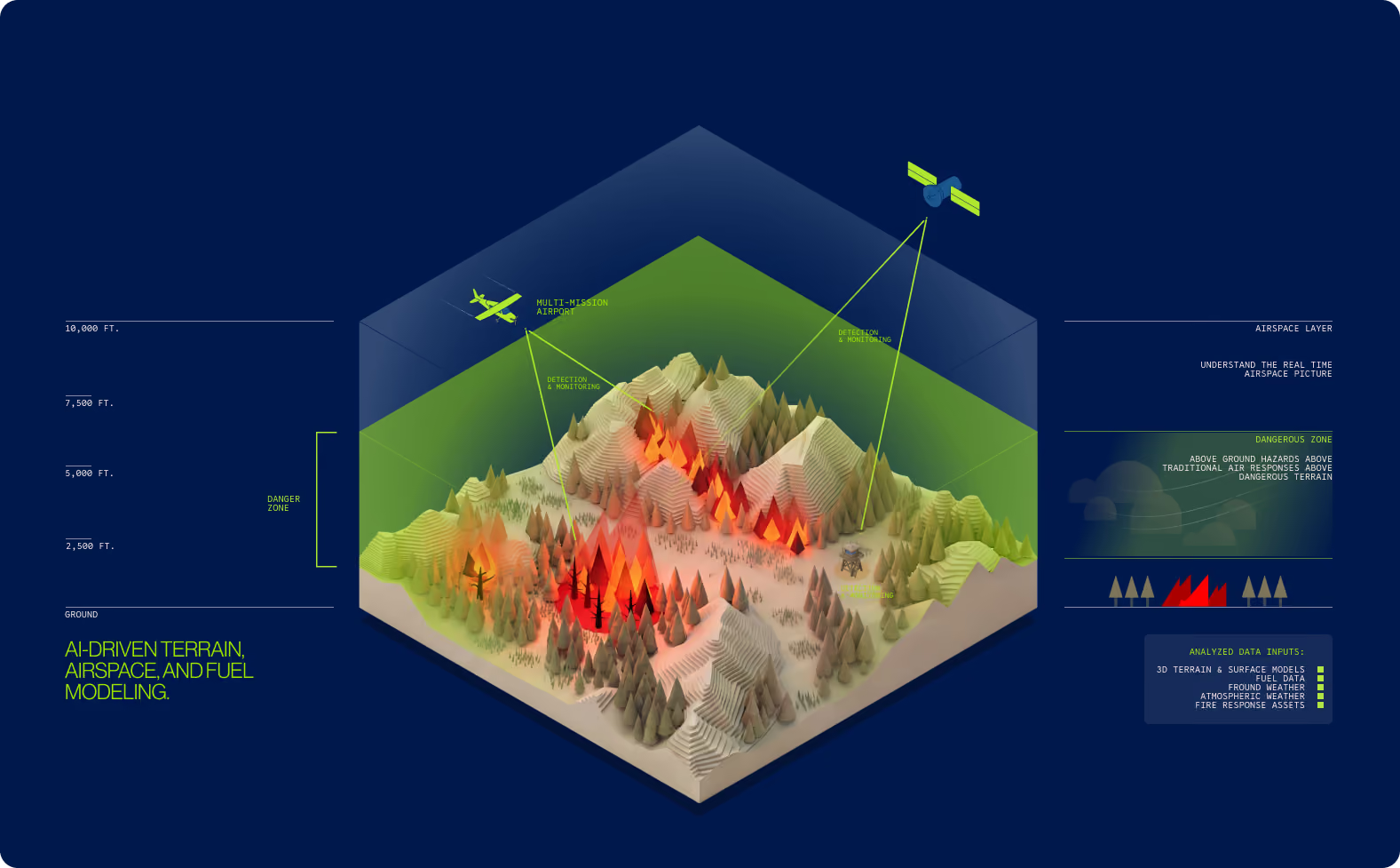
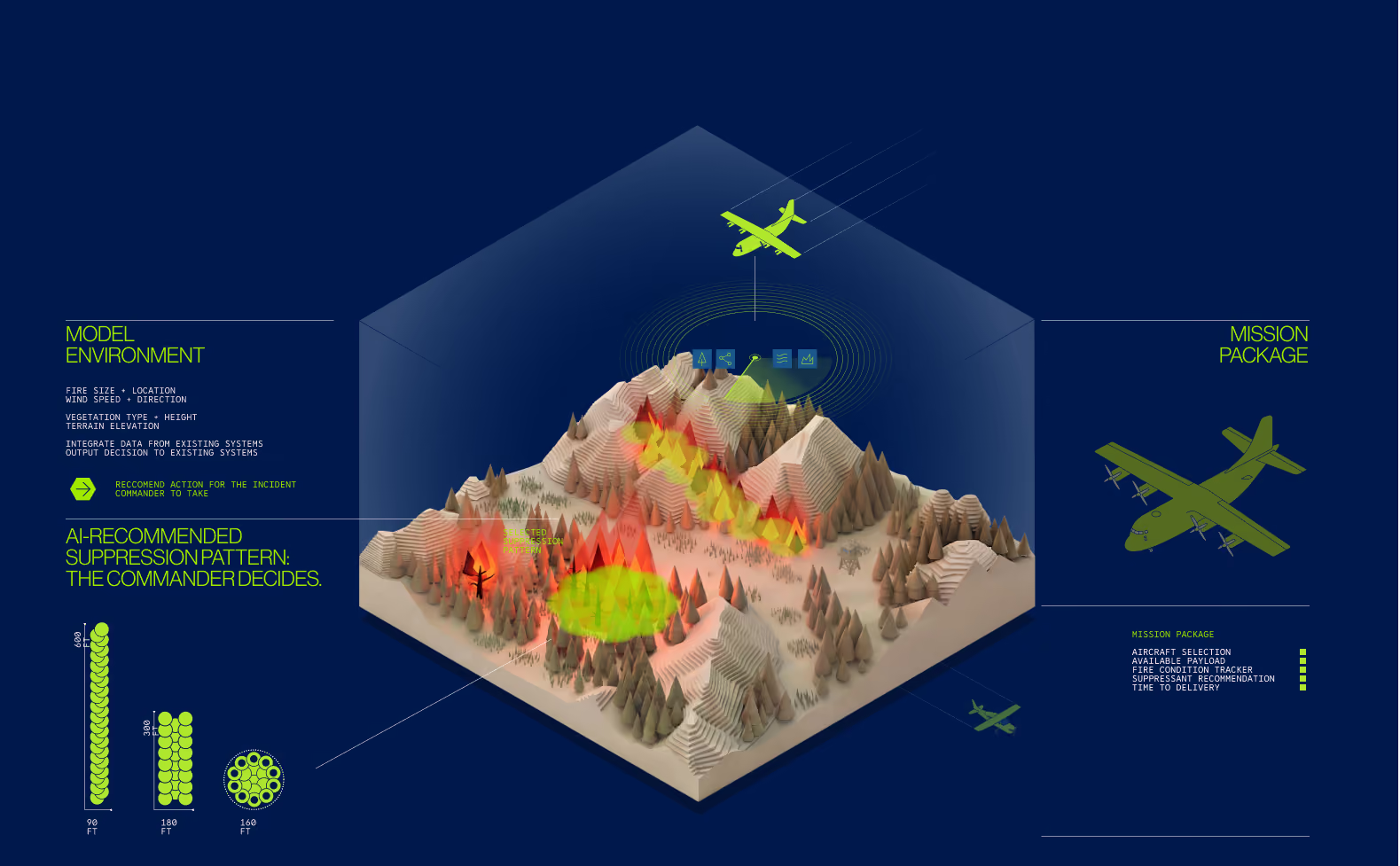
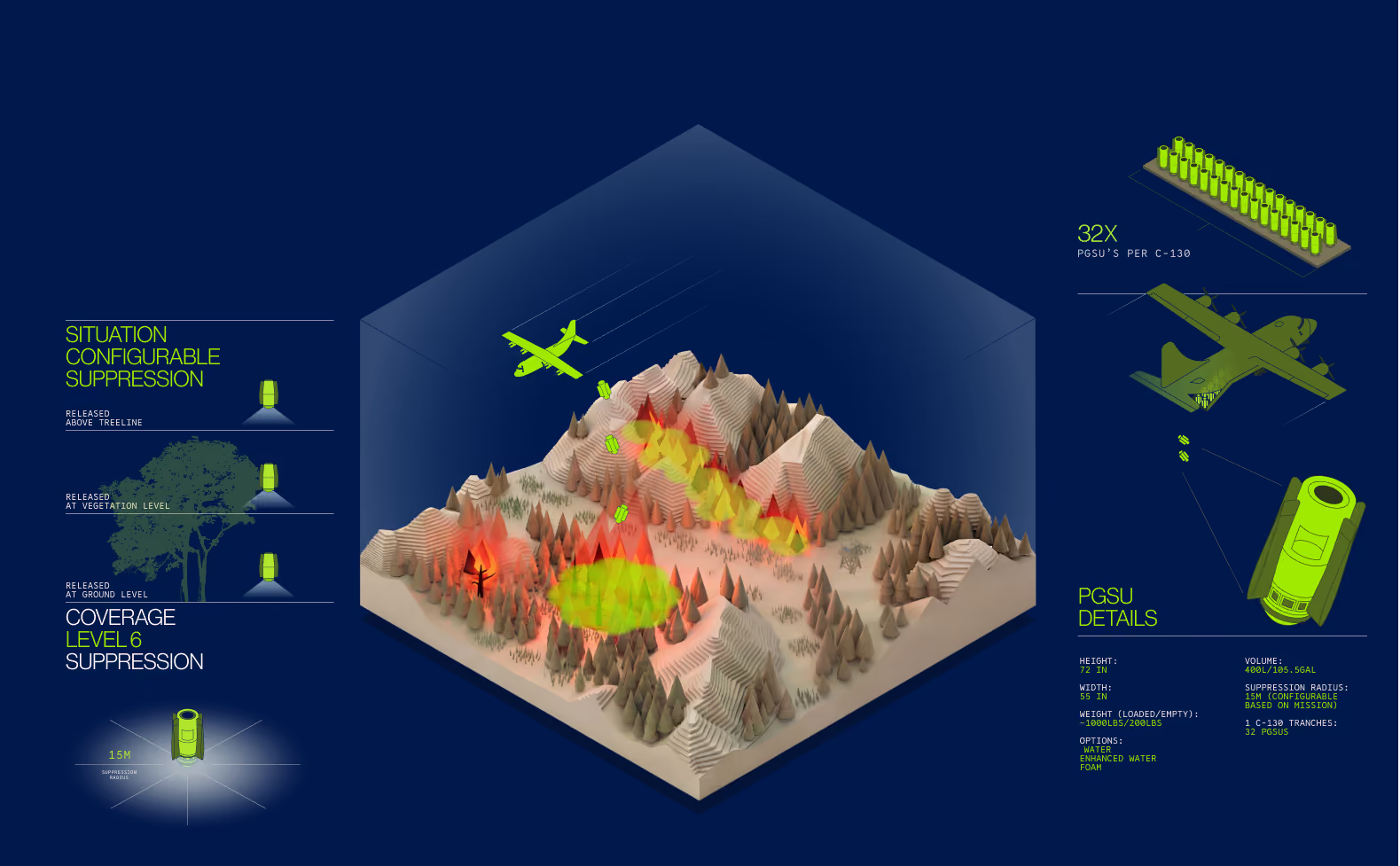
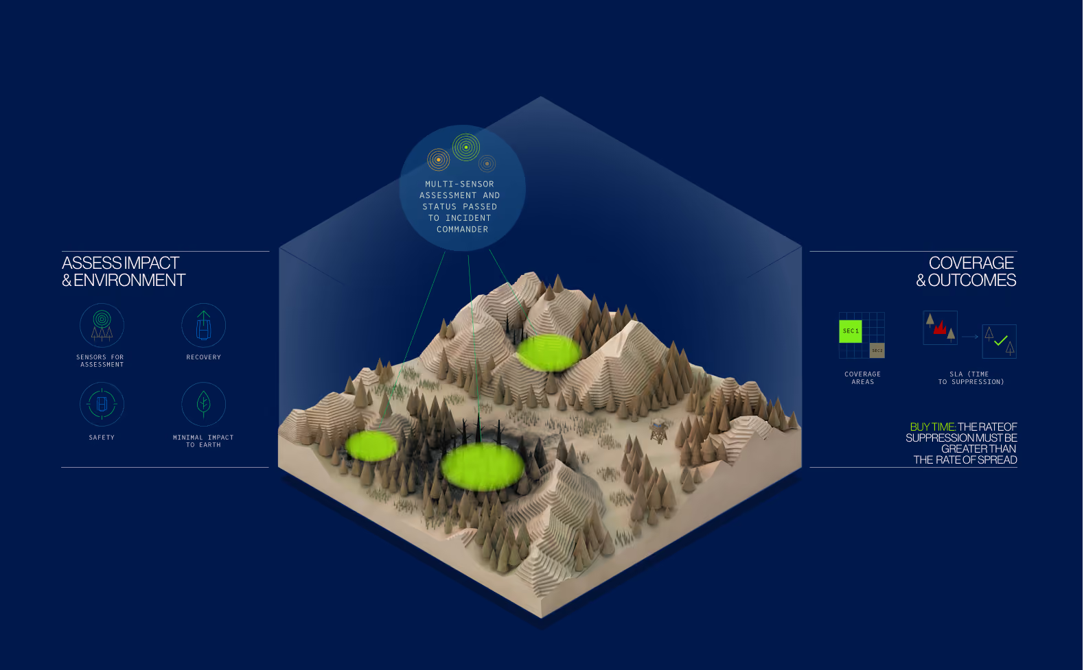
When winds are high, when the visual environment is degraded, the time to go is now.
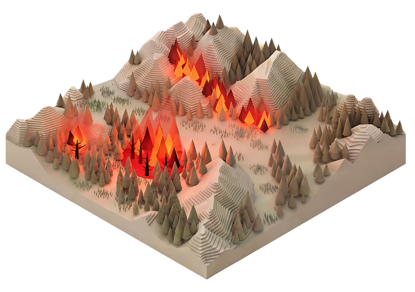
Analyze the environment
Prime Minute Mission Execution System.
The operational layer that runs the mission, building the real-time operational picture, driving mission logic and execution, managing the authorization chain, and closing the loop after every engagement. Built on operational AI.
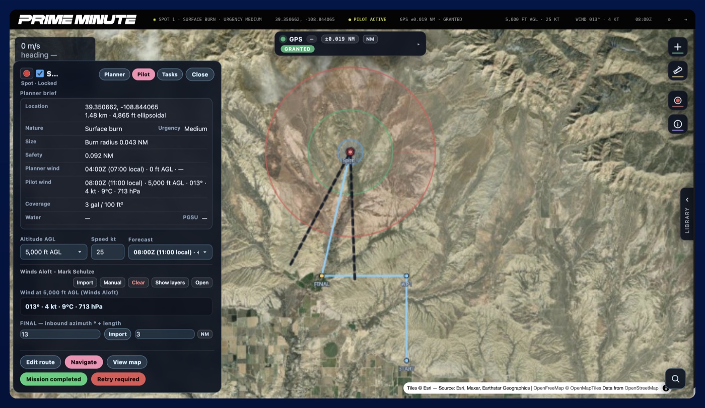
Live planning view — burn, safety, and release radii mapped to real-time winds aloft.
Hardware
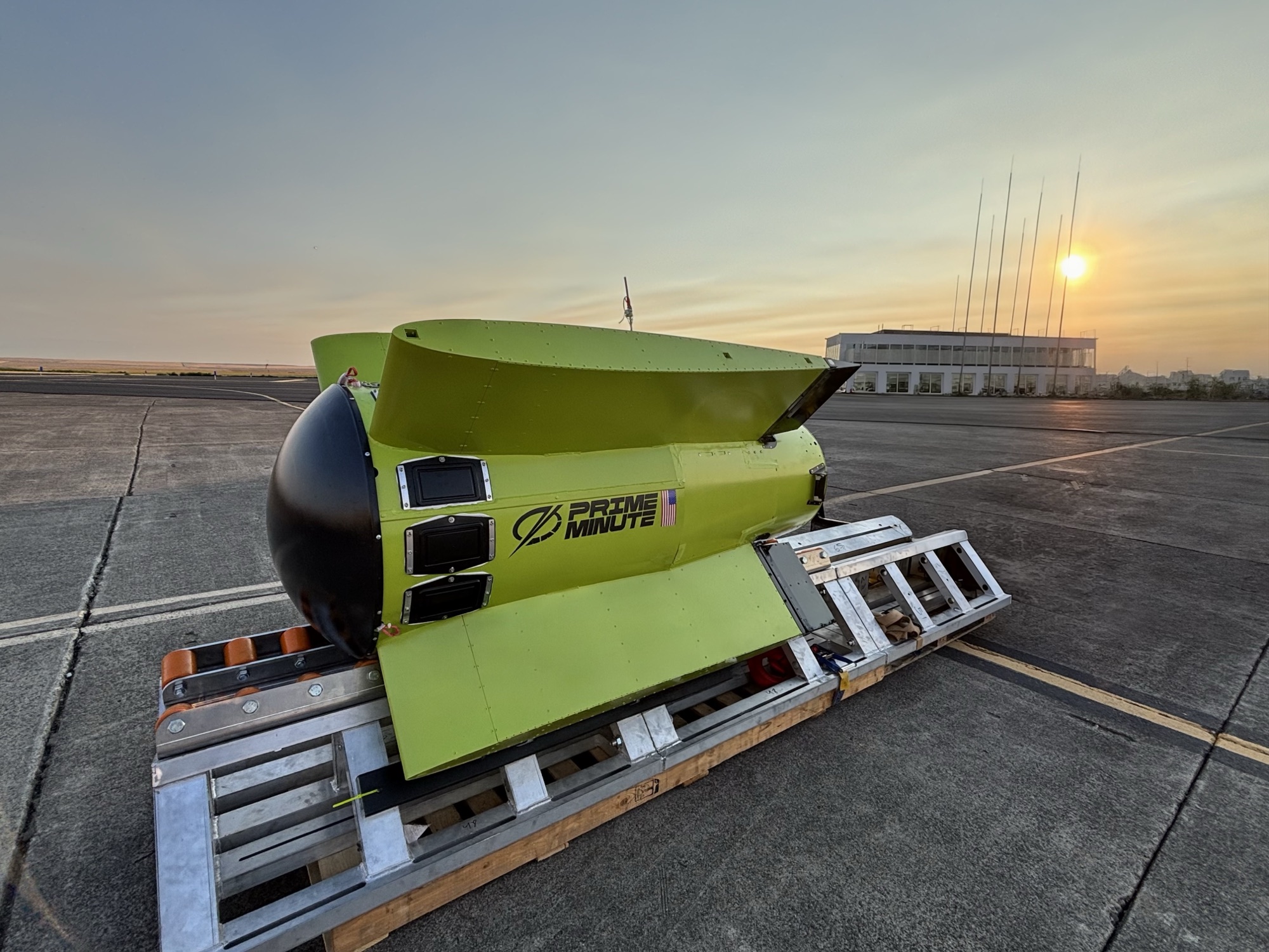
Precision Guided Suppression Unit
This is not a drone. It’s a mass of water delivered with precision — programmable to strike exact targets, at specified heights, in mission-defined patterns.

Suppression patterns